
The equipment used, is a Nikon D3100. I
am still getting used to this camera. It only has a few settings that
work for me. As you can imagine, I am not usually a 'manual'
photographer. What I need is a DSLR that has excellent automatic
modes, so I can move quickly and shoot often -- without thinking
about the camera settings. The Nikon is doing a passable job so far,
and has two automatic modes. I used the non-flash auto mode for most
of these shots. I have decided to take an online course about it
anyway, because the results (which I get from different modes) vary
widely. The thing to do, is to learn as much as I can about the
controls; and then go out into the field and shoot hundreds of frames
at the same subject in the same lighting; keeping a written note of
which frames are in which modes and settings. Then, to return home
and analyze the results.
I suspect that I will end up using an
automatic mode, the landscape mode, and the programmed mode -- and
nothing more. That is where my technique comes in, of memorizing what
the subject matters really look like before I take pictures of them.
As long as the camera does a good enough job of capturing the images,
I can justify them in photo software to what they really looked like.
The Sony's (which I have not used for
months) are just waiting for me to get tired of the Nikon. For some
reason, the Sony's have more reliable automatic modes -- more
accurate. I will tweak the Nikon until it is at its best, and write
down all of the settings for that; and then keep it as the car
camera, which is what I am using it for now.

The start of a typical day in Northern
Iowa. This dawn shot is taken on a hardtop in Webster County looking
east. I am still looking for a place on the Internet to upload all of
these pictures to, in their full sizes; so my readers can download
them in full size. I was going to use Panoramio, but it takes too
long, is map oriented, and does not allow for commentaries of my
size. I am still looking, but I expect that I will have to spend
money (spend money?) and get a file download site.
Spend money! That camera cost 400
tacos, you know!

Further along the same road going east,
still in Webster County. This is a very common site here in the
countryside, where there are no city walls or city congestion or city
buildings to block your view. All of these pictures were shot in the
last days of May and the first days of June. The dawn yesterday
looked a lot like this. Today, there are not as many clouds out; so
the sky is brighter at this time of day. You will notice, as you see
these pictures, that some areas are already green and have crops
started, while others like this are still brown. That is not because
of a time difference in the pictures. Rather, it is because of the
farmers and their reactions to the soil and mud conditions, plus
their available equipment.
I can easily understand how anyone who
does not live here will not know that different parts of Iowa grow
their crops at different times. In the mind of each farmer, that does
not have ButtUgly Windmills on his property, there is a 'Window of
Planting Opportunity' -- a range of conditions that are ideal for
planting the crops that he intends to grow this year. Outside of that
range, conditions are unsuitable.
The weather, could not care less about
farmers. The weather, also unknown to city people, does not usually
operate with huge blanket effects. Instead, Iowa is hit by as many as
six different weather patterns daily; in different sections. It is
the accumulative effect that the farmers are looking at -- the
overall weather effects on their farms.
For a farmer, it is pot-luck and the
Weather Casino. For me, it gives me photo opportunities that could
not exist if Iowa was always under the same weather.

Going east into Hamilton County. This
group of dawn shots is being taken in the tri-county area where
Webster, Hamilton and Wright counties meet. These are the kinds of
dawns that movie makers used to covet for their western movies. Out
here, you drive slower; not due to the dirt roads, they are very hard
and graded. I drive slower due to looking for pictures.

In Hamilton County, far northwest
section. From the feedback that I have received about my photographs
so far, it is clear that many different people find their own
favorites amongst them; and some people like the pictures that I do
not expect to be liked; and some people want as many pictures as they
can get, because they are somehow unable to get out and see these
sights for themselves. That presents a problem for me, because I have
been eliminating pictures that I did not consider to be good enough
for the 'general public' in bulk.
This picture has not been boosted. The
colors have not been exaggerated, in fact the Nikon over-stresses the
colors and I have to back them down in editing.

This is further north into Wright
County, looking eastwards. Those are chicken farms on the right. Hog
plants and chicken farms are housed in large rectangular one-story
buildings, and it is not the buildings themselves that are ruining
Iowa. It is the smell, within a two mile radius, and the quantity.
The people who care nothing for anything or anyone (other than
themselves) and are building more of those buildings constantly --
would literally pave the Midwest with such buildings until they were
fighting over the last few square miles of undestroyed land -- having
already covered all towns and cities with their hog and chicken
buildings. Truly, they are mindless with greed and disregard for
anything and anyone other than themselves.
I am not joking, and I am not
exaggerating the matter, when I say that they would plaster over any
town or city with their hog and chicken buildings if they could get
away with it. Nothing and no one means anything to them. Greed. Greed
is their God.
Photographically, I am the kind of
person who wants to give as much as he can, to as many Humans as
possible, of course; and at the same time I am compelled to do
everything that I can for those people who live cloistered or
confined lives. So, I have decided to include as many pictures as are
good enough to be viewed, by anyone.
By the way, if the people who are
putting up those hog and chicken buildings get their way -- every
living person in the Midwest will live tightly confined and cramped
and cloistered lives -- between hog and chicken buildings. Mark my
words!
And, mind you! Anyone and everyone who
gets a buck from the hog and chicken industries, will Bullshit You
Into Submission when you complain about the ruination of the natural
landscapes by the hog and chicken buildings.

Further north in Wright County, looking
eastwards. The farming community (in general) thinks that there will
be a necessary balance struck between the amount of hog and chicken
buildings in the Midwest, and the necessary farms and croplands on
which the food for the hogs and chickens is grown. And then, the
crowding effect of the hog and chicken buildings will stop. Stop?
What they mean is -- stop increasing; but remain at an unacceptable
level that the farming community (in general) has agreed upon.
Bullshit.

This is not in Wright County at all. My
intention is to venture to the northwest, and here I am already in
Humboldt County. This lonely horse was curious enough about me to get
closer.

A photograph of an intersection out
here. Some people like these pictures, besides just me. You don't see
this in downtown Cincinnati.

Super typical farm equipment here in
Iowa. By now I am just north of Hardy. Unknown to most people, who do
not live in farming areas, most of the food that is grown on these
lands is not for Human Consumption; nor was it intended so. The
livestock come first. Then, ethanol production. Then, general foods
for Humans -- which means the production of bulk foods for Humans as
dry goods or liquids, to go into the Mass Food Production Industries
such as Kellogg's, and Wonder Bread, and Crisco, and Nabisco,
Pepperidge Farms and Nestle's. The ingredients for many food products
-- starch, flour, oils, meal, grains.
After all of that, comes the Sweet Corn
for Humans, and the Soybeans for Humans -- as such.

I saw this waterfall and luckily I got
it on the fifth shot. This is the type of photograph that is hard to
catch, which is why I ride with the camera on at all times just next
to me. This picture has been enhanced with the objective of
highlighting the waterfall.

I wander a lot, even when I have a
direction to go in. My intention is northwest, but this was taken
further northeast; just east of Corwith. This is an indicator, of
sufficient rainfall for the wildlife.

Could be anywhere between Corwith and
Wesley. There is still enough open spaces out here to allow such
scenes of solitude.

I stopped at this intersection, since
there was a woodchuck sitting on the irrigation pipe, taking in some
rays. He can be seen swimming away in the water.

In Wesley, on the west side of town.
Here comes a fuel tanker.

Going north a short ways, I saw this
acreage.

Irrigation ditch. Value -- irrigation
ditch. Unless, you live there. There is something alive in there.

Looking south, just west of Wesley.
This photograph has been deliberately computer enhanced to bring out
every possible detail without losing any definition. The big problem
with digital photography is the editing process. When I edit a
photograph, I try to make it look like it really did when I took the
picture, including leveling. That means, I look at the scene several
times and memorize what it really was to my eyes, including levels.
Then, I take 4-12 shots of the scene at different horizontal
rotations. I have to use different rotations, because these cameras
have viewfinders that are three times too small for taking good
pictures easily. The Nikon has a large viewer on the back, but that
is only good for taking quick pictures, or unimportant pictures, or
pictures from positions that make looking into the viewfinder
impossible. Otherwise, the photos are taken with my eyes to the
viewfinder -- and universally, all viewfinders are three times too
small for good photography. Invariably, a large amount of off-level
photographs result from using the tiny viewfinders on DSLR's.
(Digital Single-Lens Reflex)
The only way to surmount that problem
is to set up the picture and camera, and then take about a dozen
pictures -- slowly and allowing the camera to adjust to the picture
electronically each time. The longer you wait for a picture to be
computerized by the camera, before you push the button, the better
picture you get -- if you have the time and you can hold the camera
still. Just because a camera has anti-shaking abilities does not mean
that you can take fast pictures that are worth anything.
Anyway, in the editing process the
sharpest picture is chosen that looks the most like the way the scene
actually looked. Then, it is edited to adjust the picture to the way
it really should look.
By doing so, details get lost due to
contrast changes and coloration and cropping. With this picture,
however, I decided to reverse the process and bring out as many
details as I possibly could; without trying to make it look like it
really did. This is a kind of computer imaging process that reveals
details for the sake of information.

I wanted to show this for the habitat
that it really is. I have mentioned this before. Iowa has the
reputation of being a huge factory floor for the industries of
agriculture, and sadly it is being treated that way. More and more
hog plants are being built all over Iowa by greedy people who have
zero regards for the beauty of Iowa, and probably do not invest in
Iowa itself, or even live here. I can easily see Iowa approaching the
wreckage and ruination of a Trash Planet, such as that which is
depicted in the Kurt Russell film 'Soldier'.
And, it is no joke. The people that are
ruining the state do not give a crap what happens to any state, or
any county, or any people, or any culture; they are the ultimate
manifestations of greed and avarice and selfishness, and will spend
whatever monies are required to generate propaganda campaigns that
claim the opposite of what they really are.
One need only walk along one of these
canals and check the tracks to realize how many animals rely upon
these water corridors for their existence.

Empty.
Do you remember what I said about the
Diaspora of the 1980's here in Iowa? It was a phenomenon in which
small farmers by the hundreds gave up their farms to larger farmers,
took what they could get for those places, and left for the 'big
cities'. Many small farms were consolidated into large ones, leaving
behind many empty farmhouses on the overall properties of the new
larger farms. Those abandoned houses, and the lands immediately
around them, became known as 'acreages'.
Most acreages were sold to
'non-farmers', who were looking for homes in the country, or second
homes 'out-in-the-sticks' -- and so the supply of such acreages
dwindled, as the available ones were bought up. Those that were not
sold or purchased lapsed into ruination; the ruined ones are still
being torn down today.
However. There is now a Second Diaspora
occurring. It is caused by another sociological problem, errant
children. The children of the 80's and the 90's are now leaving farms
for the 'big cities' -- having never gained any appreciation of
farming as children due to being exposed to the putrid malice and
vile lies of the TV Turds.
Thus, the Second Diaspora is a kind of
vengeance for the First Diaspora. No matter what the size of the
farm, the children who are expected to carry on the farming tradition
have their brains filled with Queer Propaganda from the TV Turds; and
are now leaving the farms, forever. Thus, farms are being put up for
sale in pieces.
And, the Queer TV ruination process
continues. The satanic IPTV (Iowa Perverted TV) is now forcing
innocent people to see their Queer Programming by duping institutions
(such as medical clinics) into allowing IPTV to install Queer TV's
(that can only view IPTV Queer Propaganda) in their waiting rooms and
public areas. Thus, forcing their brainwashing upon any and all
innocent people who happen to go to those places -- purely for
reasons having nothing to do with wanting to be Queer.

This is a vertical composite of two
photographs. It shows a stream that is literally impossible to see
until you are right on it. As you can tell, canals and streams are
very similar in size here.
If you were the last person on Earth
...
if you had to walk across Iowa, after
everyone else ceased to exist ...
you could not ask for more of a mystery
...
and your life could not be more at
chance.
Streams and canals, such as this,
seldom reveal themselves at a distance. Your best bet, would be to
travel from greenbelt to greenbelt -- if you could see that far.
However, in many cases greenbelts are too far apart to be seen from
each other.

This is another picture which I
enhanced to show as much detail as possible. I left it unleveled
deliberately. That is Titonka in the far background.

I am just west of Titonka, in Kossuth
County. I still want to go northwest.

I am starting to get into the Union
Slough area, which is a small paradise that is partly a National
Wildlife Sanctuary.

This is an earthworks being dug right
next to the sanctuary. Strange thing is, the road that I am on
(shooting this picture from) was in the process of being covered
over, by the county trucks, with dark dirt. The trucks were spending
hours laying down a thick mat of dark dirt along this road, to be
used by the county's road graders later -- but none of it came from
here. The trucks would drop a swath of dirt on the road, and then
leave to go get some more. Same kind of dirt, but the county was
bringing their dirt in from somewhere else.
People in Kansas must look at this
picture, and get green with envy. The topsoil in Kansas is six inches
deep at best, before hitting the rock layers. Here, you can see that
the topsoil is yards deep. Here, there is so much topsoil that they
rebuild the roads with it.
I went through Union Slough, and came
out on the west side to find this. I took this picture and then
returned to the slough, with the intention of walking in and getting
some photos of the river itself (Buffalo Creek).

The next eight pictures are from the
Union Slough depression. The elevation of it all is below the level
of the Great Plains.


---

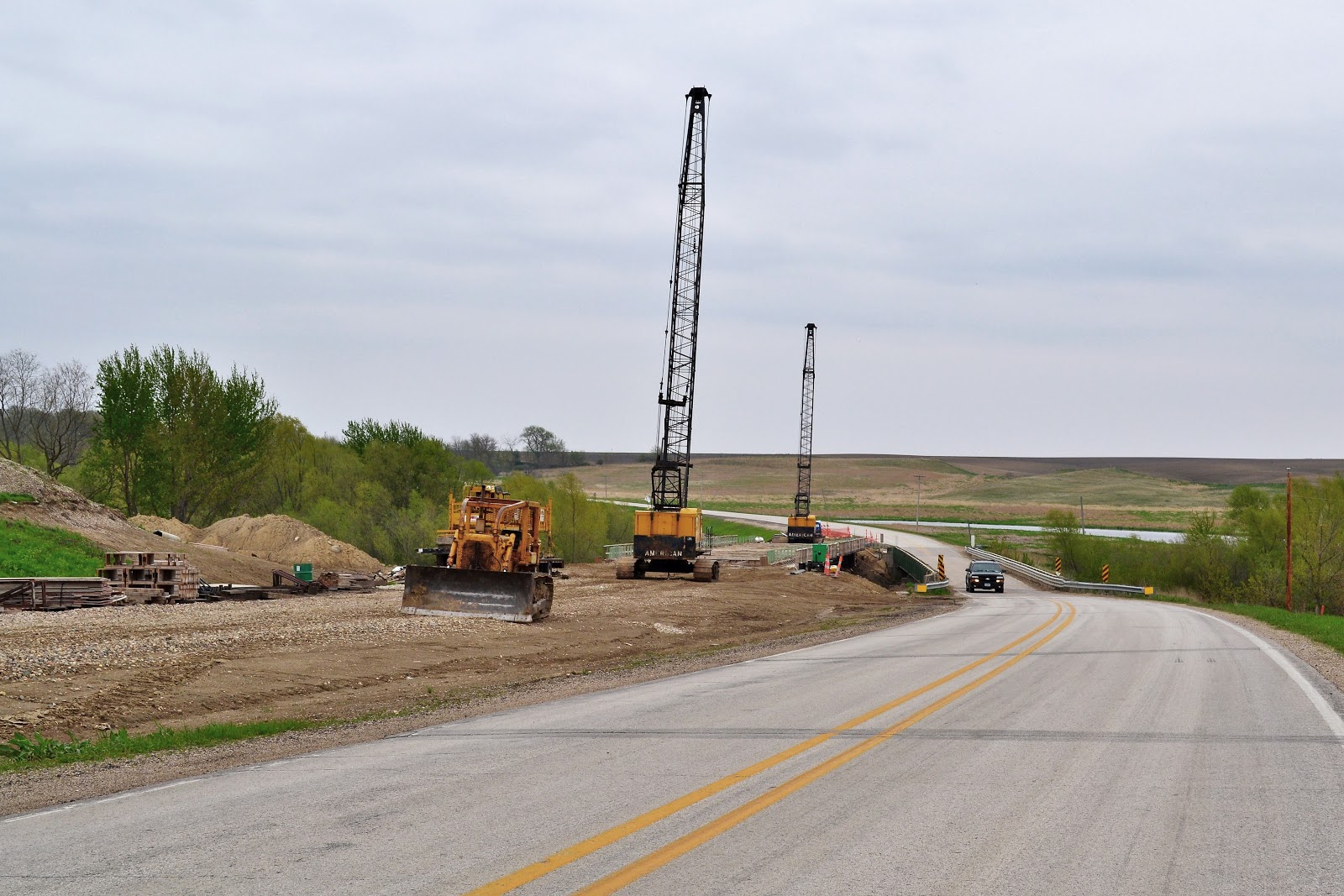
Still trying to get west, having gone
far enough north, I came across this familiar structure. Most of
these are falling down from decades of neglect. This one is still
pretty well built.

The Electric Sub-station at the End of
the Universe. Or, so it would seem to any city victim that would see
all of this as 'out-in-the-middle-of-nowhere'. I know where
'the-middle-of-nowhere-is', and it is far from such places as this.
It is commonly known as -- 'Nude Yack'.

This one worked out well. I wanted to
catch the impression of 'edge ecology', and the surrounding
environment.

Moving on westwards, leaving the Union
Slough area behind me. Now the land flattens out again. This is very
deceiving. At this ground elevation your horizon is about 6-7 miles,
and that is like being in a restricted zone. Of course, the horizon
moves with you as you travel; but almost every place in the Midwest
is not discernible for what it really is -- until you are right
there. At a range of six miles, the most that you can know about any
place is its most general characteristics such as greenbelt, flats,
or town with elevator.
Hence, you can be looking for places
like Union Slough, and if there are two of them that are fifteen
miles apart and you travel right between them, you will never know
that they are there; because both are beyond your 6-7 mile horizon.
Plus, the kinds of places and scenes that I am always looking for are
not on the maps.

Case in point, further west I found
this place, north of Emmetsburg. Lesson here: take a good look at
this scene. The next thirteen photographs come from that line of
green that you see on the far horizon behind the farm. If I had not
looked for them, I never would have known that they were there.


All of this, is in the West Des Moines
River proximity. This is now Palo Alto County. Think Gold.

This is a lazy sidearm of the West Des
Moines River. I sat here under a tree for fifteen minutes, waiting
for the next shot.

I knew he was there, but he was hidden
and on the other side. He likes to come right up to the bank and
browse in the mud for delicacies. I took at least twenty frames of
him, and only these two came out good enough to view.

I had to computer enhance both of
these, to try to make him stand out in the pictures. He was not what
I was looking for, though. What I was trying to photograph had been
on a rock in the river, sunbathing. But, I woke it up and it dove
into the water before I could get a picture.

Case in point. Who would know such a
sight exists anywhere as this, unless you are actually there. This is
just a small slice of a big area that is all natural and photogenic.

I fired off a dozen attempts to get
this guy, one succeeded in getting him to hold still.
I knew what kind of environment I was
in, and I knew that no video or photo collection could ever show a
trifle of what it looks like. So, I chose another tack. I decided to
make desktop backgrounds (wallpapers), instead. In fact, a lot of
what follows was done with 'wallpapers' in mind. Of course, they are
for all Humans -- so feel free to use them accordingly.


Wallpapers from that area.


The West Des Moines River itself, a
mecca for life in a big prairie.

This is taken about 70 miles from
there, as the crow flies, back in Wright County.
Now, I am going east towards an
objective. I am still looking for a certain kind of animal, which I
almost got a picture of over by Emmetsburg. I take photographs like
this (as I said), for the shut-ins, and the immobile people, and the
confined people -- all of whom I can feel riding with me while I
search for pictures to take.
Nonetheless, I still follow my own
ideas about what to take pictures of. Usually.

This is a horizontal composite, a
melding of two photographs side-by-side. It is, what it is. I see
these scenes and realize that I cannot show it all -- but I hope to
give enough sense of what is there to make it worth viewing. This
canal is usually packed with blackbirds fighting, but I scared them
all away when I arrived.

Still in Wright County, close to the
last photograph.
I hope a lot of you read this note --
this is the kind of picture that reveals to us that our present
technology is so incapable of showing to us what we really need to
see.
****We need Panoramic Computer
Screens****
As in wrap-around. Smoothly flowing and
curved screens that can assume a Cinerama-type curvature, with us in
the middle of the foci. Push a button, and they change (physically)
from flat screens to Cinerama Screens.
Imagine -- the Truth of it. This is
just one frame, in the middle of a screen that should be showing you
five frames -- a picture five frames wide, so you can really start to
get the idea of what is in front of you. Add sound, and you begin to
get the idea.
If Google had the bandwidth, I would
start to create video sessions instead of still photographs. That,
would give you HD 720P videos (I don't think they have 1080 yet) with
sound. I have the cameras for that, and I have my own collections of
course.
Alas -- as always -- I am ahead of
technology. I have ideas about what is possible, that you have never
heard the like of.

So, there I am driving east this time
-- heading for the place where I expect to find that elusive animal
-- and I see a tractor buzzing along on a road parallel to mine. The
town in the background is 'Woolworth'.

I turned north briefly, and took this
long shot of Eagle Grove to the east.

Another middle frame of what should be
at least three frames wide and curved to proper perspective.

I take these pictures for a sense of
completion, and/or they interest me. You can see that in this part of
Iowa the planting was done earlier, so the corn is above ground now.
Not so in other parts of Iowa.

Further east on the same road. This
pond is completely impossible to see until you are there. There is no
way of knowing it is there, until you find it. The Midwest has many
of these.

I stopped and took about forty pictures
of the birds here. They live under the bridge, of course. I enhanced
this one to highlight the birds.

I call these the Land of Oz shots. They
give you the feeling of distance and unknown horizons.


More wallpapers. I looked around here
for that elusive animal, but they were all hiding. I know they are
here.

This is a pastoral widescreen view of
an elevated area of farms, still inside Wright County.

Getting close to where I expect to find
my target. I am now in the Iowa River watershed, still in Wright
County.


Still looking. Is he here? Is he there?
Is he under there?


Hah! At last!
He was so cleverly disguised as a rock
in the road. He almost had me fooled. I was a quarter mile past him,
before I realized it was him. If he had been a rock in the grass, on
the edge of the road -- he would not be World Famous now.
Only big enough to make a sandwich out
of -- and since he was cooperative, and did not give me a lot of
trouble -- I sent him toddling off into the tall grasses.

A look at the east, during sunset. The
colors here are not computer enhanced. I used a computer enhanced
version of this for a website cover recently, which looks quite
different from this.
*************************
Markel Peters