This episode of the Here series almost
did not happen. I was too busy with writing and working to go out and
take photographs, but then I unexpectedly had a week off from
working; so I decided to go out for three days.
Prairie Creek at Bridge
I uploaded this one first and according to Badoogle it is still processing while the others are already finished. I tried the download, and it downloads. If Badoogle mucks this up I will upload it again and give you to new link to it in a new message soon.
On Mineral Ridge--View
When you go to this link it offers you a player to preview it with, before you download.
Mineral Ridge--Creek
This one also offers a player for previewing.
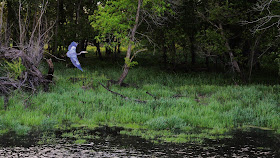
I have no idea about the bird. I think it was fishing in the pool below the surface.
Please set the screen colors of your computer and monitor to 'default' temporarily. Remember your previous settings.

*************************

Just a random shot to get things
started.


In Goldfield.

Going north from Goldfield.


 Starting to turn eastwards now. The
skies are mostly clear, but at ground level there is a very intense
wind going north-northeast.
Starting to turn eastwards now. The
skies are mostly clear, but at ground level there is a very intense
wind going north-northeast.
 Looking northwards. The top layer of
this canal is being blown northwards with wave action while the flow
is heavy and southwards. If this intense wind was also going
southwards there would be sine waves in the canal higher than the
sides of the canal.
Looking northwards. The top layer of
this canal is being blown northwards with wave action while the flow
is heavy and southwards. If this intense wind was also going
southwards there would be sine waves in the canal higher than the
sides of the canal.

 Still going eastwards, zig-zagging
towards downtown Olaf.
Still going eastwards, zig-zagging
towards downtown Olaf.


 Olaf.
Olaf.


 At a conservation area north of Olaf.


 Still going eastwards, zig-zagging
towards Nashua.
Still going eastwards, zig-zagging
towards Nashua.


 The also-illusive Blue Heron, except
this one looks decidedly purple-ish on some of my computers. I passed this bird at 45mph and went
another quarter mile and turned around. Herons can be blue or grey -- usually grey -- and always ignore passing traffic at
45mph. I knew that he would take off when I glided back at 2mph, so I
had the window down and the camera ready. The lighting was dark, but
I got these shots to prove his existence.
The also-illusive Blue Heron, except
this one looks decidedly purple-ish on some of my computers. I passed this bird at 45mph and went
another quarter mile and turned around. Herons can be blue or grey -- usually grey -- and always ignore passing traffic at
45mph. I knew that he would take off when I glided back at 2mph, so I
had the window down and the camera ready. The lighting was dark, but
I got these shots to prove his existence.


 Dougherty in the distance.

 Dougherty.
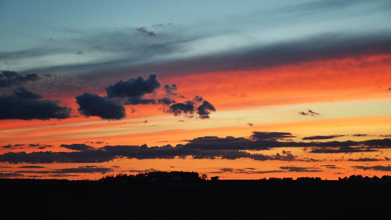
 From Dougherty I returned west and
caught this picture of the sunset before turning south on other
business. End of Day 1.
From Dougherty I returned west and
caught this picture of the sunset before turning south on other
business. End of Day 1.
 Start of Day 2, which you will not see
much of because I do not think you would be interested. No wind on
this day. Remember, I am still taking videos too.
Start of Day 2, which you will not see
much of because I do not think you would be interested. No wind on
this day. Remember, I am still taking videos too.

 In Wright County, north of Belmond.
 Going east again.


 I have now turned completely around and
I am north of Clarion.
I have now turned completely around and
I am north of Clarion.
 Now north of Goldfield.
 End of Day 2.
 Day 3 begins with a Real Iowa Classic.
 Sneaky cat just east of Woolstock. I
passed him at 45mph while he was digging in a drainage pipe for a
mouse. When I returned, he saw me coming back and hid in the grass.
Sneaky cat just east of Woolstock. I
passed him at 45mph while he was digging in a drainage pipe for a
mouse. When I returned, he saw me coming back and hid in the grass.
 Very typical one lane bridge out here.
 Never pass up a good rock pile.
Everyone needs a good rock pile. What would the world be without rock
piles? I have left Wright County after deciding to go up onto Mineral
Ridge, which proved to be very difficult due to very wet and muddy
roads everywhere on the ridge.
Never pass up a good rock pile.
Everyone needs a good rock pile. What would the world be without rock
piles? I have left Wright County after deciding to go up onto Mineral
Ridge, which proved to be very difficult due to very wet and muddy
roads everywhere on the ridge.
 At the top, and guess who is already
here.
At the top, and guess who is already
here.
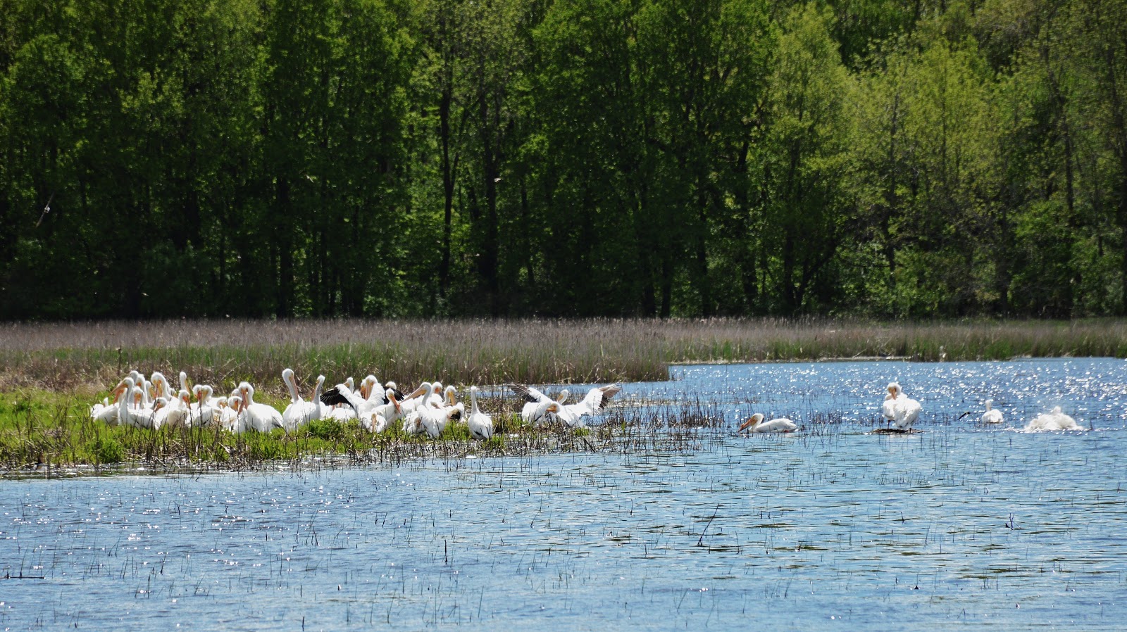
 Those ever-illusive pelicans again.
 Very close by, still on the ridge.
 The creek that you see in the video
runs down from the ridge into this valley.
The creek that you see in the video
runs down from the ridge into this valley.


 From this point onward I am taking
desktop background photographs for my readers.
From this point onward I am taking
desktop background photographs for my readers.

 The remainder of these shots are taken
in the Pilot Mound area in Boone County.
The remainder of these shots are taken
in the Pilot Mound area in Boone County.


Even so, I was not going to release
this episode of the Here series. I have too many other things to do.
Then, while I was out in the field for three days taking photographs,
a Good Crazy Person came driving along and told me that it was a
great idea to take pictures of Iowa. He meant the Real Iowa. I was
still not convinced, but then back at 'Civilization' two Bad Crazy
Persons told me that it was a bad idea to do anything except
manufacture artificial vaginas for the anuses of each and every
Filthy Monkey Horror in each and every FM station -- so the poor
freaks can have a gender again. Or, at least imagine that they do.
Whose advice do you think I took?
----------
My main idea this time was to create
1080p videos of the Real Iowa that would help people to relax.
Meditative videos, without a lot of fast action about nothing. During
my three days in the middle of everything I made six videos, three of
which you will see here.
Prairie Creek at Bridge
I uploaded this one first and according to Badoogle it is still processing while the others are already finished. I tried the download, and it downloads. If Badoogle mucks this up I will upload it again and give you to new link to it in a new message soon.
On Mineral Ridge--View
When you go to this link it offers you a player to preview it with, before you download.
Mineral Ridge--Creek
This one also offers a player for previewing.
I have no idea about the bird. I think it was fishing in the pool below the surface.
Each of these videos will require about
3 Gigabytes of data to download. Depending upon your Internet service
it could cost you as much as $10 to download each Gigabyte. You must
decide if it is worth it to you. It will add videos to your
collection that are probably unlike anything else that you have; no
people, no games, no noise, no flashing lights, no plastic interest,
no hype. Just the Real Iowa.
If my readers like these I can easily
make many more. They are converted to mp4 format, so Windows Media
Player and VLC will play them without the need for extra codes. The
photographs only happened because the shots were there as I traveled
around several counties looking for scenes to take videos of; thus
the collection represents what is really here without any intentional
emphasis.
*************************
Please set the screen colors of your computer and monitor to 'default' temporarily. Remember your previous settings.

With all of these pictures I had to
decrease the green. If I show them at the real level of 'greeness'
that exists out here, no one who does not live here will believe how
intense the greens are -- and -- because of the technology of the
cameras such an intense 'greeness' reduces the details of the
picture. This picture is shown without any reduction of the green
color so you can see what I am talking about.
*************************
These are shown in chronological
sequence.


Immediately north of Eagle Grove with
Goldfield in the background.


Looking southwards, same bridge.


Floodwaters just north of Olaf.


And there they are again; the
ever-illusive Great American White Pelicans. Nice of them to NOT
notice that clump of grass crawling on the ground holding a camera.


Sunset just west of Dougherty.


Now I turned southwards and went to
Atheist Aims on business. This is just north of Atheist Aims.
 Looking at Atheist Aims from the
northern heights. That large forest in the background houses Atheist
Aims.
Looking at Atheist Aims from the
northern heights. That large forest in the background houses Atheist
Aims.

West and north of Atheist Aims, down in
the Des Moines River Valley.


*************************
As you can see, the Real Iowa still
exists -- no thanks to the ButtUgly Windmill Imperials and the Big
Business White Assholes. In Reality, I took twice as many shots as
you see here, but I removed half of them because I did not think you
would be interested. They remain in my archives.
*************************
Markel Peters